如何在买房前解读地形高低
2026年9月16日
land contour.
Land contour can affect the position of the house, water flow, the need for cut and fill, construction costs, the drainage system, and even your comfort once the house is occupied.
The good news is, you don't have to be a geologist to start understanding it.
There are at least a few simple things you can pay attention to when surveying a house or plot of land.
What exactly is meant by land contour?
Simply put, land contour describes the highs and lows of the ground surface.
If you look at a contour map, there are usually lines connecting points of the same elevation.
The numbers on those lines indicate elevation.
For example, there might be numbers like:
80 — 85 — 90 — 95 meters
This means the area has differences in height.
The closer the distance between contour lines, the faster the elevation change tends to be, meaning the land tends to be steeper.
Conversely, lines that are more spread out indicate a gentler change in elevation.
This simple detail can give you a picture of the shape of the land before you even see it in person.
Why is land contour important when buying a house?
Because water has one habit that can't be negotiated:
it flows from higher places to lower ones.
If you don't know the direction of the land's slope, you might end up buying a house that turns out to sit at a low point and more easily receives water flow from the surrounding area.
That doesn't mean every low-lying plot will definitely flood.
But elevation conditions need to be understood together with the drainage system, water channels, the surrounding environment, and the history of standing water in that location.
Besides water, contour can also affect construction.
Land with a very steep slope may require additional work such as cut and fill, retaining structures, or a building design that adapts to the slope of the land.
In other words:
different contours can result in different construction requirements.
A simple way to read land contour
There's no need to get overwhelmed looking at the lines on a map right away.
Start with the following points.
1. Look at the elevation numbers
Find the numbers marked on the contour lines.
The bigger the number, the higher the elevation.
If the number changes from 80 to 90, that means you're looking at an area where the elevation rises.
From here you can start to understand:
which areas are higher and which are lower.
2. Pay attention to the distance between lines
This is one of the easiest ways to read the degree of slope.
Close lines = steeper slope.
Spread-out lines = gentler slope.
Imagine you're walking.
If the elevation change happens over a very short distance, you'll feel a sharper incline.
If the elevation change happens gradually, the path will feel gentler.
The concept is roughly like that.
3. Pay attention to the shape of the lines
The pattern of contour lines can also give clues about the shape of the land surface.
Lines that form a certain pattern can indicate a valley, a ridge, or a higher area.
One pattern worth paying attention to is the V shape.
In a valley or water flow path, the contour pattern can form a V that points toward the low area or the flow direction.
This matters because you'll want to know:
"When it rains heavily, where does the water come from and where does it flow to?"
4. Find the highest and lowest points
If you can identify the highest and lowest points in an area, you'll get a clearer picture of the possible direction of water flow.
A lower area isn't automatically problematic.
But that area needs to be examined more carefully.
What is the drainage like?
Is there a water channel?
Has there ever been standing water there?
Does water from higher areas flow toward that location?
Questions like these are far more important than simply knowing that the land is "sloped."
Flat land isn't necessarily problem-free
Many people assume:
flat land = the safest option.
Not always.
Flat land is indeed easier for many types of construction compared to land with extreme slopes.
But drainage still needs to be considered.
Imagine a relatively flat ground surface that doesn't have a good water disposal system.
When it rains heavily, water can be trapped there longer.
So don't just look at:
"The land is flat."
Also look at:
"Where does the water flow to?"
What about sloped land?
Sloped land also isn't automatically bad.
In fact, contoured land can have certain advantages.
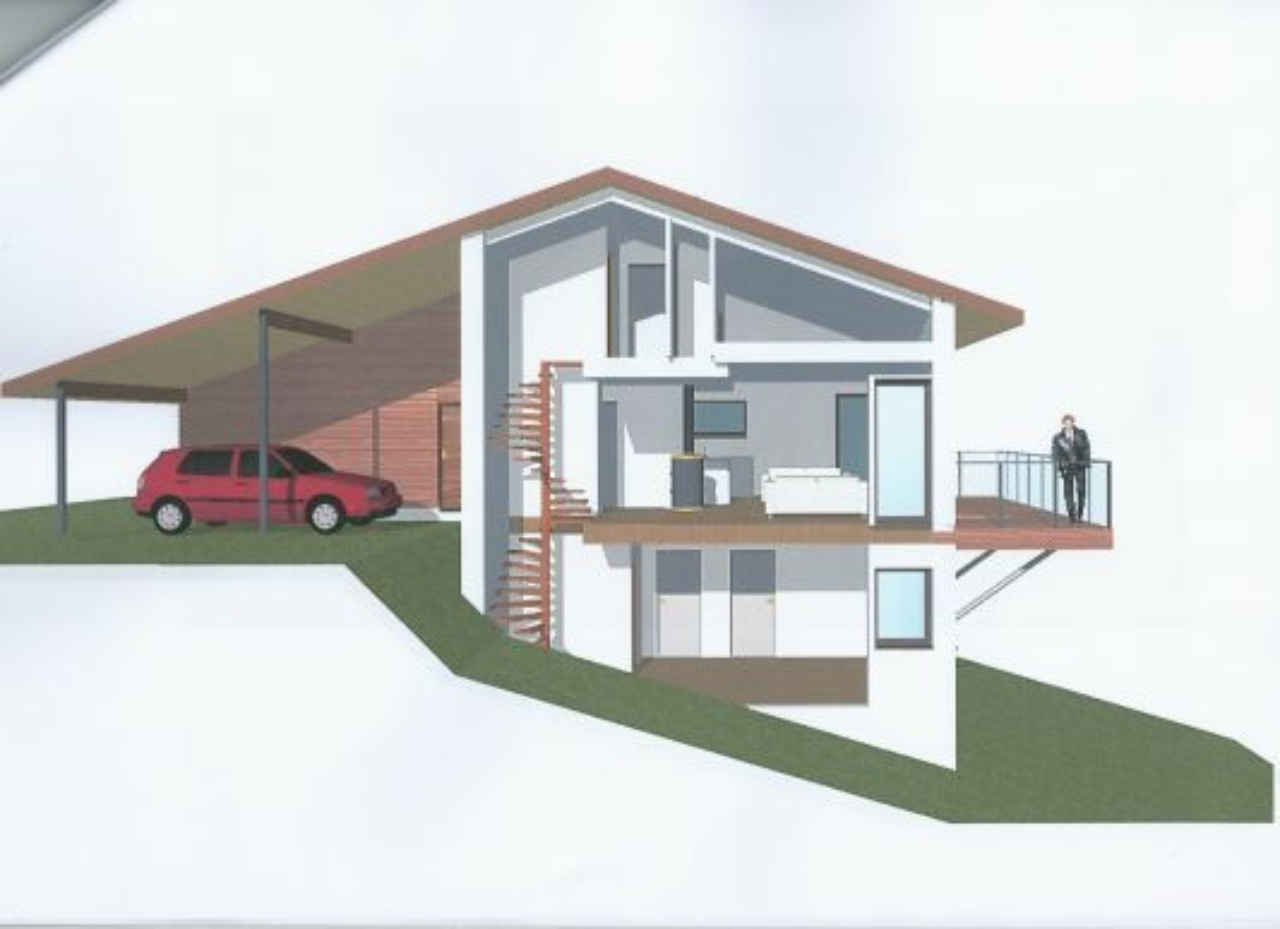
With the right design, a sloping plot can be used to create multi-level houses, split-level layouts, terraced gardens, or a house design that follows the natural shape of the land.
The problem arises when the slope isn't accounted for from the start.
The more complex the land conditions, the more important the technical planning becomes.
Because there could be additional needs for:
- cut and fill
- foundation work
- drainage
- a retaining wall or soil-retention structure
- floor-level adjustments
- slope stabilization
So don't immediately assume:
"Sloped land must be bad."
It's more accurate to ask:
"Can this land's slope be handled with a reasonable design and cost?"
One thing to pay attention to: the retaining wall
If you come across a house or plot of land with a fairly significant difference in elevation, check whether there's a retaining wall present.
Its function, among others, is to help hold back the mass of soil and manage differences in elevation.
However, the presence of a retaining wall doesn't automatically mean the land is safe or problematic.
What matters is examining its condition.
Are there any cracks?
Is there any seepage?
How is the drainage system?
Does it appear well-maintained?
For complex conditions, an inspection by a professional is certainly more appropriate than relying solely on visual observation.
Don't just look at the land. Look at the road in front of it too.
This is often forgotten during a house survey.
The house may sit on a fairly good plot.
But what's the elevation of the road in front of it?
If the road is positioned much higher than the house, you need to understand how rainwater is managed.
Conversely, if the house is positioned much higher than the road, vehicle access and carport design also need to be considered.
A level difference that looks small during a survey can become significant once you start thinking about:
vehicle access, drainage, entryways, and everyday comfort.
Try visiting after it rains
This is one of the simplest yet most useful tips.
If possible, survey the location after it rains.
You'll be able to directly observe:
- which parts get flooded
- the direction water flows
- the condition of the drainage
- whether the road easily floods
- whether there's any soil erosion
- whether there's seepage on walls or certain areas
Indeed, the conditions after just one rain can't be the sole basis for making a decision.
But direct observation can provide additional information that isn't always visible when the weather is clear.
Don't forget to ask the local residents
A contour map can provide information about the shape of the land.
But local residents can provide information about real experience at that location.
Try asking:
"What's it usually like when it rains heavily?"
"Has there ever been standing water here?"
"Which direction does the water usually flow?"
"Have houses around here ever had soil or drainage problems?"
Simple questions like these can help you get a more complete picture.
Contour is also related to cost
This part is important for prospective buyers.
Two plots of land with the same size may not necessarily require the same construction cost.
For example:
Plot A: relatively flat and ready to build on.
Plot B: has a fairly significant slope and requires level adjustments.
Both are 100 m² in size.
But the earthwork required can differ.
Because of that, when you see cheaper land, don't just think:
"I'm saving Rp100 million on the land price."
Try to continue with:
"Are there additional costs I need to spend to get this land ready to build a house on?"
The land price is only the starting point.
So, what should you check during a survey?
Before buying a house or land, try to look into at least the following:
1. Elevation
Which parts are higher and which are lower?
2. Slope
Is the land flat, gently sloping, or quite steep?
3. Direction of water flow
When it rains, where does the water move?
4. Drainage
Is there adequate water channeling available?
5. Surrounding conditions
Are there slopes, rivers, or low-lying areas nearby?
6. Road conditions
What's the level difference between the house and the road?
7. Location history
Has there ever been standing water, erosion, or soil problems?
8. Construction requirements
Is cut and fill or a retaining structure needed?
If there's a part that's hard to understand, don't hesitate to ask for help from an architect, surveyor, or other competent professional.
Don't be afraid of contoured land
In the end, contoured land doesn't mean bad land.
In fact, contour can become part of an area's character and be used to create an appealing house design.
What should be avoided is buying without understanding the conditions.
Because once the house is built, land contour is no longer just a line on a map.
You'll experience it through:
flowing water, vehicle access, the house's position, the garden, drainage, and even maintenance costs.
So the next time you survey a house, don't just look at:
"Is the house nice?"
Try looking down.
Pay attention to the land.
Look at the slope.
Find out where the water flows.
And understand how the house stands on its plot of land.
Because a good house isn't just one with a nice building.
A good house is one that stands on land that is well understood.
Looking for a House in Semarang?
Land contour is just one of the things that need attention when choosing a property.
Location, access, the surrounding environment, building condition, drainage, nearby facilities, and your own needs also need to be considered as a whole.
If you're looking for a house in Semarang and are still unsure about which area or property suits you, tell Mirailand about your needs.
We'll help you find property options based on budget, location, and needs, so you can make a decision with more thorough consideration.
Mirailand — helping you find the right place to call home.